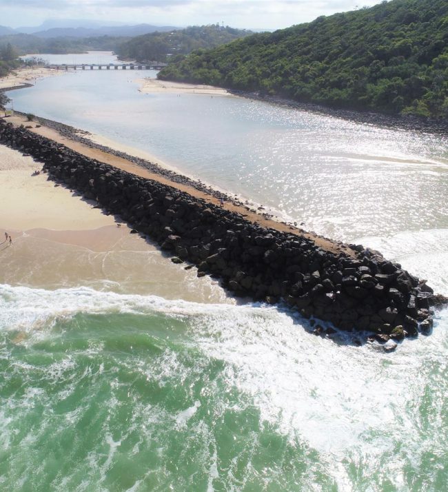
Drones allow us to safely and efficiently capture imagery of sites and structures, with minimal interference with ground operations. Drones allow us to capture large areas extremely quickly, reach inaccessible areas and reduce risk to survey personnel by eliminating ground work around plant and machinery. Drones allow us to rapidly deploy and capture data and our advanced processing techniques allow us to provide end products within 24 hours, which is ideal for rapidly changing environments such as quarries, landfill sites, beach erosion and mines.
Photogrammetry involves capturing a series of images, along with survey ground control and image processing to eliminate relief displacement and scale distortions, to create a geometrically corrected Orthophoto. Orthophotos are generally used as a base for Geographic Information Systems (GIS) and other applications include for urban and infrastructure planning, asset inspections, agriculture, mining exploration, forestry and coastal management, construction progress, environmental disturbance, drainage modelling, archaeological and heritage documentation and site planning.
Aerial Imagery can also be processed to produce Digital Elevation Models (DEM) and Digital Terrain Models (DTM), providing a digital representation of the ground terrain or surface topography respectively. The orthophoto allow us to extract 2D and 3D data from the imagery for items such as road edges/centrelines, structures, vegetation extents and roof levels.
Depending on project requirements, we can tailor our Aerial Survey data capture, processing methods and accuracies to meet client’s budget and needs.