Mobile LiDAR


Mobile LiDAR

Mobile LiDAR Systems, also known as Mobile Laser Scanning (MLS) incorporates survey grade LiDAR sensors with Spherical Vision cameras and Global Navigation Satellite Systems (GNSS), mounted on a vehicle to acquire LiDAR data from a moving platform. Mobile LiDAR is ideally suited for mapping of linear infrastructure such as rail corridors, roads and motorways as the technology utilises non-invasive survey methods to efficiently acquire 3D data. The end result is an accurate high-resolution 3D point cloud that can be used for City Modelling, Mapping for Autonomous Vehicles, Concept Design Planning, Feature string extraction and Digital Terrain Modelling for engineering design, mapping corridor assets and assessing condition of roads, rail and infrastructure. This system also incorporates high-resolution imagery, captured simultaneously during scanning, to allow point cloud colourisation to give end users a better perspective and accurate representation of the site.

Mobile LiDAR has many advantages over traditional survey methods for corridor mapping. Mobile LiDAR systems operate at up to 1,000,000 measurements per second at 5mm accuracy. Coupled with the ability of being mounted on a vehicle and driving at highway speeds, means Mobile LiDAR can extremely quickly capture many kilometres of a corridor at a higher point density when compared to traditional survey methods. The higher point density provided by Mobile LiDAR also provides a better perspective and accurate representation of the subject area when compared to traditional survey. Utilising Mobile LiDAR also reduces the risks involved in having survey personnel in high risk situation as the data can be captured remotely, day or night and under normal traffic conditions, minimising the time survey personnel are required on the pavement working amongst traffic. This too comes with cost savings as Mobile LiDAR greatly reduces the requirement for traffic control systems when compared to traditional survey methods. This in turn minimises the disruption to traffic flow. Obtaining traffic management approvals can involve local councils and police and is generally a 4 week turn around. When working to a tight programme these additional constraints can be reduced by utilising MLS. In many parts of the world, MLS is now the preferred option for data capture unless circumstances mean it cannot be utilised.

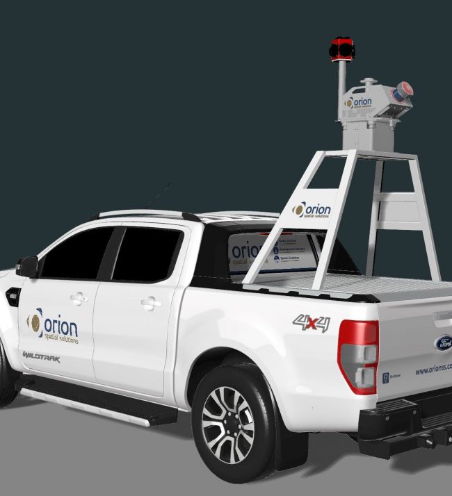
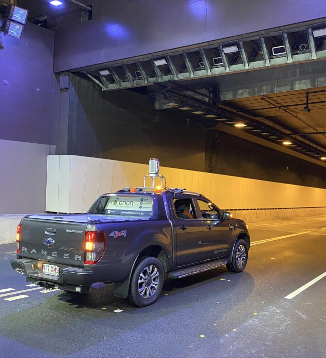
Mobile – Stop and Go LiDAR

A hybrid of Mobile and Terrestrial methods, Orion’s Stop and Go LiDAR system incorporates a survey grade 3D Laser Scanner mounted on a mobile platform. The system requires the 3D Scanner to be stationary for each window of capture, but still producing survey grade 3D point clouds. The Stop and Go LiDAR system comes into its own in Global Navigation Satellite System (GNSS) denied environments like tunnels. Stop and Go LiDAR does not rely on GNSS for positioning of scans, alternatively it uses target and cloud to cloud registration. This allows us to create survey grade 3D models of infrastructure such as tunnels using a cost-effective, efficient and safe method.

This system also incorporates high-resolution imagery captured simultaneously during scanning to allow point cloud colourisation to give end users a better perspective and accurate representation of the site.

Mobile LiDAR Projects

Privacy Settings
We use cookies to enhance your experience while using our website. If you are using our Services via a browser you can restrict, block or remove cookies through your web browser settings. We also use content and scripts from third parties that may use tracking technologies. You can selectively provide your consent below to allow such third party embeds. For complete information about the cookies we use, data we collect and how we process them, please check our Privacy Policy
Youtube
Consent to display content from - Youtube
Vimeo
Consent to display content from - Vimeo
Google Maps
Consent to display content from - Google